Project Details
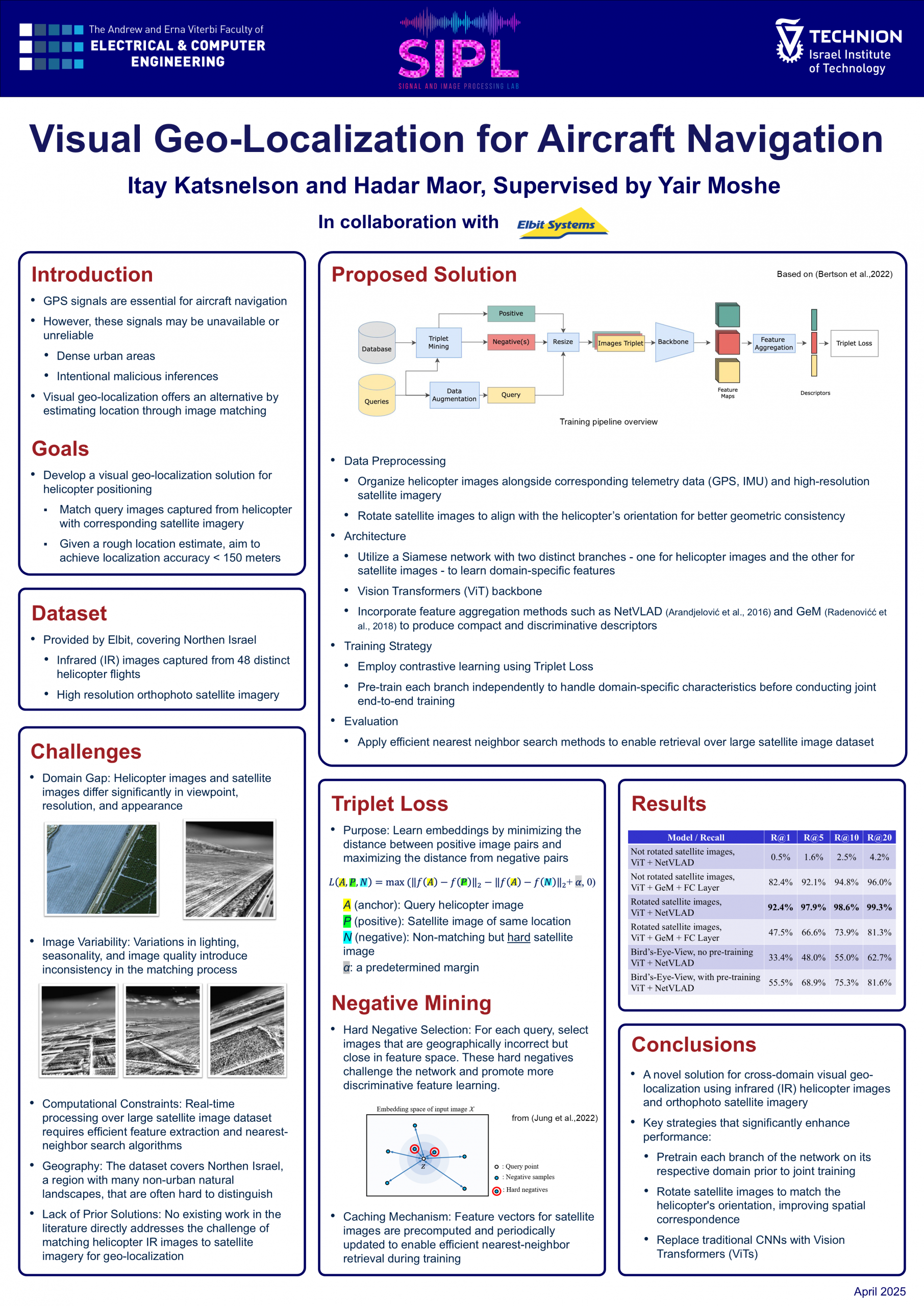
Today, GPS and location information is widely used and essential for many means of transportation and varying tasks, creating the need for reliable alternatives for self-localization when such signals are obstructed or limited. The task of coarsely estimating the place of a photo (Visual Geo-Localization) is a rapid growing field of research, offering an alternative method for estimating location. It is addressed using image matching methods on a database of images of known locations. In our project, we explore geo-localizing helicopters using satellite images, by modifying state-of-the-art practices from ground-to-ground and aerial-to-ground matching problems. The fact that cameras are relatively cheap in comparison to the specialized hardware usually deployed for such tasks, and that most helicopters and other aircrafts already possess cameras for various other tasks, offers a significant advantage for developing such systems, requiring only a modest amount of computing power.