 Project Details
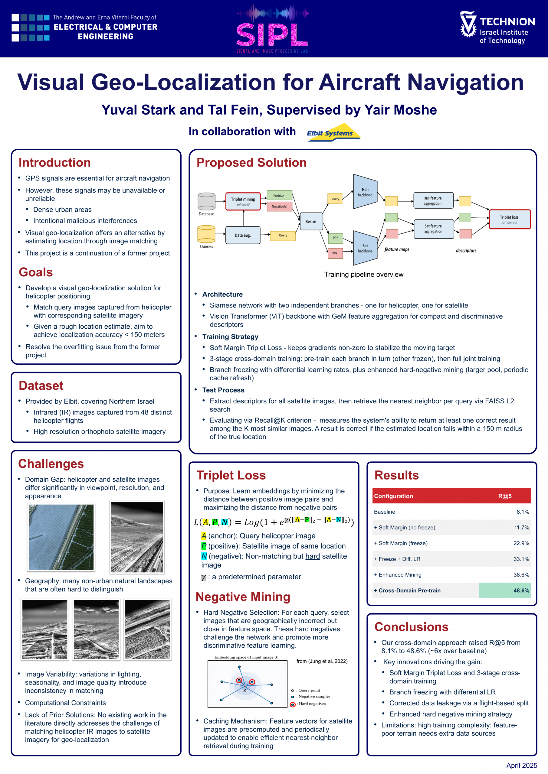
This project is a direct continuation of a project that focused on developing a visual geo-localization system for a helicopter. In the previous project, a deep neural network model based on a Siamese architecture was developed to match images captured by an infrared camera mounted on a helicopter to satellite imagery. In the current project, we pursued systematic improvements to this system. We discovered that the dataset underpinning the previous project results suffered from a significant data leak between the training and test sets; once corrected, the baseline model collapsed. Against this backdrop, we introduced several key innovations: a switch to a Soft Margin Triplet Loss function, a three-stage cross-domain training strategy incorporating branch freezing and differential learning rates, and an enhanced hard-negative mining strategy. These improvements drove an impressive increase from 8.1% to 48.6% on the R@5 metric on the corrected dataset.